


col de la chaudière-les 3 becs-pas de la laveuse

JMJ42
User
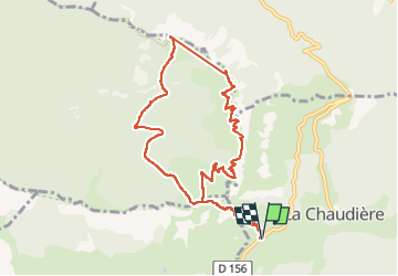

Length
10.7 km

Max alt
1565 m

Uphill gradient
809 m
Km-Effort
21 km

Min alt
1021 m

Downhill gradient
808 m
Boucle
Yes
Creation date :
2022-04-16 07:10:38.261
Updated on :
2022-04-16 13:43:32.241
3h07
Difficulty : Medium

FREE GPS app for hiking
 SityTrail
IGN / Geographical institutes
SityTrail Plus
The world is yours!
About
Trail Walking of 10.7 km to be discovered at Auvergne-Rhône-Alpes, Drôme, La Chaudière. This trail is proposed by JMJ42.
Description
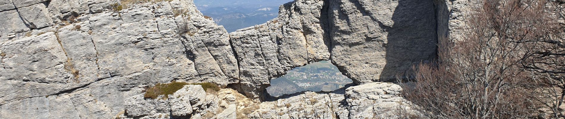
magnifique rando
Photos


Positioning
Country:
France
Region :
Auvergne-Rhône-Alpes
Department/Province :
Drôme
Municipality :
La Chaudière
Location:
Unknown
Start:(Dec)
Start:(UTM)
674892 ; 4944145 (31T) N.
Comments